For communities and neighbourhoods to be attractive and accessible, there must be an efficient transportation system in place to cater to the needs and demands of various users. The number of cyclists has increased over the years for reasons such as staying active, lowering greenhouse gas emissions, and avoiding traffic congestion. Many areas are becoming more urban, with high-density areas that require bike paths and walking paths in addition to roads to create a healthy and active community.
However, creating safe transportation systems for all kinds of users can be hard when there are competing requirements and demands for limited space. The use of pavement markings for pedestrians and cyclists in addition to traffic signs, can help communicate and create order in communities with high transportation mode splits.
In this two-part series, we will be discussing how pavement markings and traffic signs work together to make communities both safe and accessible for pedestrians and cyclists.
Right now, let’s look at how pavement markings and signage make an impact on cyclists and how they can make their lives safer.
A comfortable shared use of environment for all users
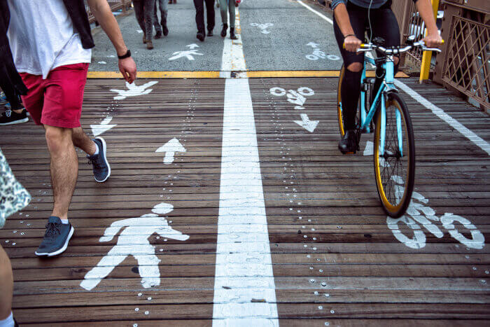
As communities implement multi-modal plans, a key consideration is how they will impact all users—pedestrians, cyclists, and motorists. By providing pavement markings in combination with signs, transportation engineers and planners can create a safe and comfortable environment for all road users. This clearly communicates to every user that using signs and markings will eliminate confusion and create a more desirable commute, even for the most vulnerable.
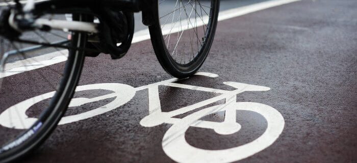
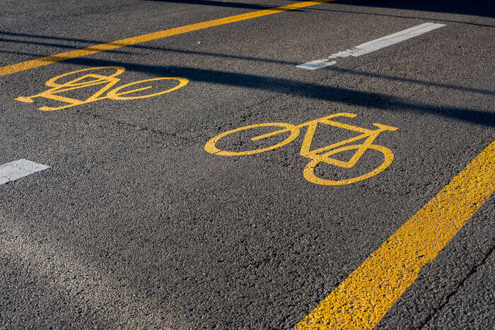
When using shared lanes, appropriate markings allow cyclists and vehicles to position themselves properly and navigate safely in their designated lanes. When used in addition to signs, these markings notify other users to be cautious of cyclists sharing the road with them. In the same vein, while markings communicate to the users of the road, when combined with speed limit signs, the reduced speed will increase the driver’s awareness about other vulnerable users such as cyclists and promote better safe driving behaviour.
Therefore, a correct implementation of both signage and marking lessens the likelihood of accidents and creates a comfortable shared-use environment for all users.
Designating bicycle boulevards encourages new cyclists
As mentioned previously, the use of pavement markings combined with signs helps to create a safer environment on the road. At the same time, designating cycle boulevards on local streets with low speed and low traffic volumes by using signs and pavement markings is a great way to implement safe transportation facilities for cyclists.
Bicycle boulevards indicate a shared roadway where the priority for cyclists is emphasized, and speed is limited. As a benefit for these vulnerable road users, this strategy also discourages through vehicle and truck movements.
The designation as a bicycle boulevard not only provides a safe space for cyclists but also encourages new users. Cycling is not only a solution for congested roads, but it also has the potential to mitigate climate change. When the number of cars reduces, the use of bicycles increases, and so does the sustainability and health within the given community.
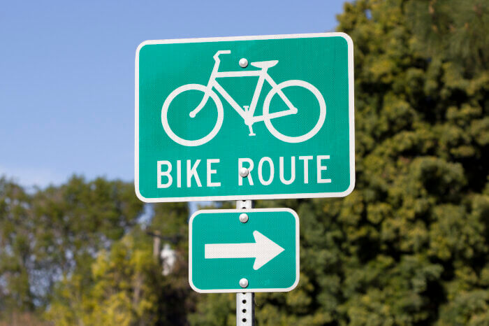
Wayfinding: Using Signs to Navigate toward a Destination
Wayfinding signs work along with pavement markings to improve the confidence of cyclists by guiding them to their intended destinations along safe and comfortable routes, such as those with bike lanes or other cycling facilities.
Good and accurately placed signage connects neighbourhoods to recreational areas like parks and beaches, which allows users to discover new explorations. By showing the direction and distances to key destinations, wayfinding signs especially help new cyclists improve their navigational skills and explore their new form of transportation within their community by learning local roads and places.
When city planners and transportation engineers transition projects into the planning and designing stages, it is useful to use software applications like GuideSIGN that help design traffic signage within the CAD platform.
GuideSIGN supports various guidelines such as MUTCD, State DOTs and more. Additionally, with many locations named in diverse languages, GuideSIGN includes French and Spanish accent marks to accurately spell out the destinations. Utilizing these features can create an inclusive community and encourage cyclists from all backgrounds to partake in the great outdoors. Communities appear to be more attractive when they are interconnected with a variety of activities for new or existing members to explore.
Signage and pavement markings are some of the many tools for road and bicycle safety, even as they augment other operational functions on the road with traffic calming measures such as geometric design and changes to create safe and efficient facilities.
The next time you’re travelling within your city, take note of how every signage and marking impacts your end-to-end journey, and maybe consider a cycling adventure.